Polloquere Hot Springs
Polloquere Hot Springs
Geothermal pools on the edge of the Surire salt flat, at 4,200 m altitude in northern Chili. Andean wildlife, free access and camping with views of extinct volcanoes.
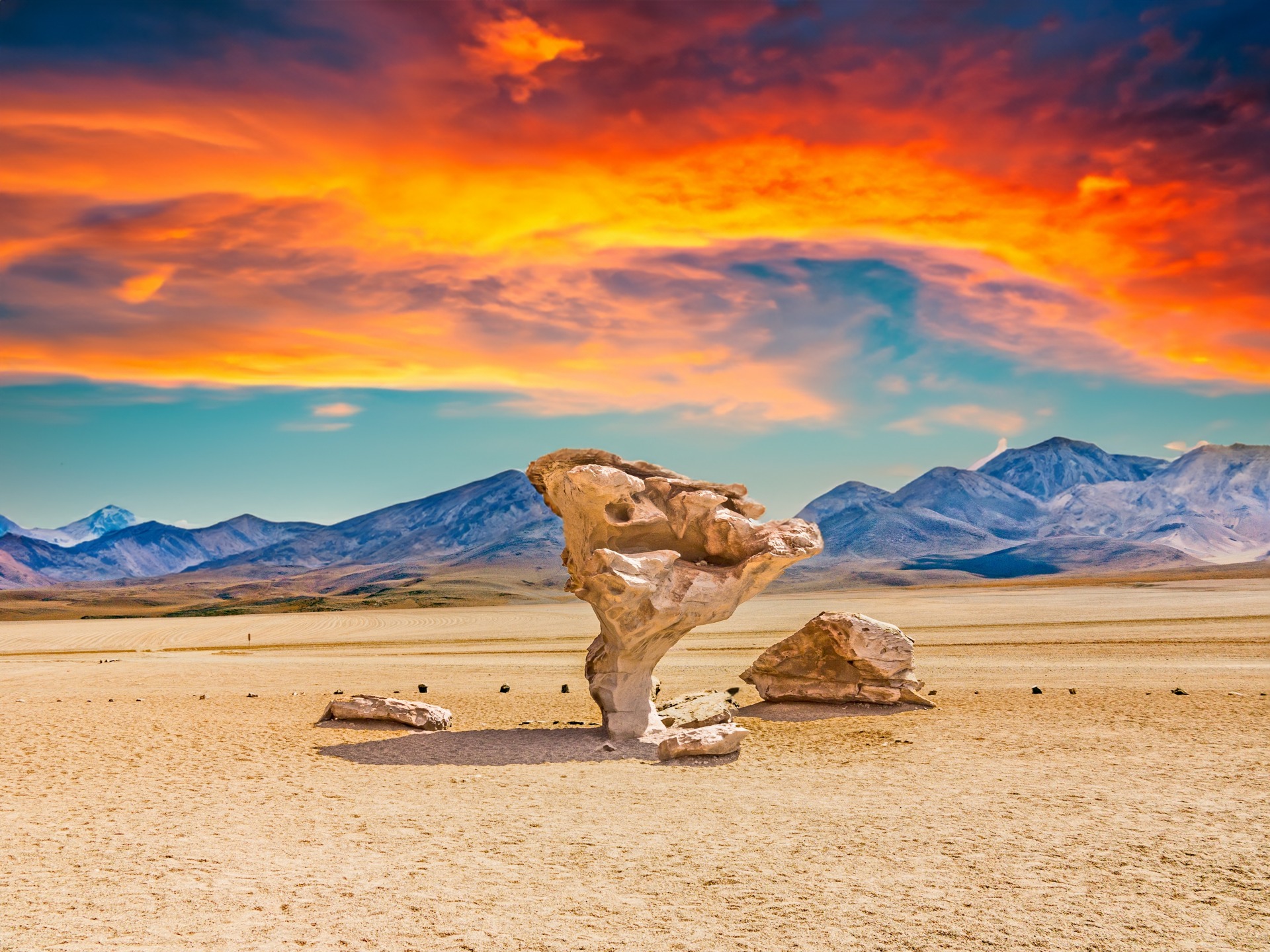
The Polloquere hot springs form a pair of geothermal pools on the edge of the Surire salt flat, in the Arica and Parinacota region at the northern tip of Chili. At approximately 4,200 metres altitude, the site combines open-air thermal bathing, Andean wildlife and a mineral landscape dominated by extinct volcanoes.
Why visit Polloquere Hot Springs
Polloquere remains one of the most isolated hot springs in northern Chili. The site has no ticket office or tourist infrastructure: access is free and unrestricted, and visitor numbers remain low even during peak season. This remoteness is its greatest asset.
The appeal lies in the rare combination of two thermal pools and the landscape of the Surire salt flat, a high-altitude salt lake where Andean flamingos thrive. The contrast between the steam rising from the waters and the white expanse of salt, bordered by volcanoes, gives the place its distinctive character.
What to see and do
The thermal pools
Two adjoining pools fed by geothermal springs lie on the edge of the salt flat. Temperatures exceed 60°C in the hottest section and remain very high in the second pool: bathing requires testing the water before immersion and keeping time in the water brief. No medical facilities are available on site, and the healing properties attributed to these waters by local tradition (rheumatism, skin conditions) are not supported by validated clinical studies.
Wildlife of the Surire salt flat
The salt flat is home to three species of Andean flamingos (Chilean flamingo, James's flamingo, Andean flamingo) that breed here. On the margins and in the nearby reserve, you may also encounter:
- vicuñas and, more rarely, herds of llamas and alpacas;
- Darwin's rheas, large flightless running birds;
- mountain viscachas, rodents related to chinchillas;
- Andean avocets and other high-altitude water birds.
The surrounding landscape
The pools are surrounded by pale dunes and extinct volcanic cones. At the entrance to the salt flat, the road skirks a flamingo breeding centre whose access is prohibited to visitors. The track then runs alongside the salt lake for 13 km until reaching the hot springs.
Practical Information
- Access: Free and unrestricted, with no ticket booth or official opening hours.
- Altitude: Approximately 4,200 metres — prior acclimatisation is essential.
- Equipment: Swimsuit, towel, sandals for the mineralised pools, water, strong sun protection, warm clothing for the night.
- Camping: Camping and picnicking permitted at designated spots, with no services (no drinking water, electricity or facilities).
- Basic changing area on site.
When to visit
The best period extends from April to November, during the altiplano's dry season. Days are sunny, but nights drop below freezing year-round at this altitude. From December to March, the "Bolivian winter" brings afternoon storms and sometimes heavy rain that turns the track into mud, making it impassable. Best to avoid this period or build extra time into your schedule.
For bathing, the contrast between cold air and warm water is most striking early morning and late afternoon.
How to get there
Polloquere lies approximately 150 km from Putre, an Andean village that serves as an acclimatisation base, and over 250 km from Arica on the coast. The road is partly paved until the reserve entrance, then becomes an earth and gravel track. A high-clearance 4x4 vehicle is very strongly recommended, particularly after rain, despite occasional claims of two-wheel-drive access in dry conditions.
Two options are common:
- Organised excursion departing from Putre or Arica, generally over two days to manage altitude and distances.
- 4x4 rental car with fuel reserves (no petrol stations on route), water and provisions.
The route passes through Las Vicuñas National Reserve, the hamlet of Guallatire at the foot of its volcano, then the Surire salt flat mining operation before reaching the hot springs.
What to see in the region
- Las Vicuñas National Reserve: Protected area crossed along the route, populated by vicuñas.
- Guallatire: Small high-altitude village dominated by the volcano of the same name, still active.
- Surire salt flat mining operation: Visible from the track.
- Azapa Valley: Cultural stop accessible from Arica before or after the expedition.
- Atacama Salt Flat and Tara Salt Flat: Other high-altitude Chilian salt flats further south.
Frequently Asked Questions
Frequently asked questions
Planning your trip
Polloquere Hot Springs fit into a northern Chili circuit combining Arica, Putre, Lauca Park and the Surire salt flat. To build an itinerary suited to altitude and distances, consult our Chili trips.
Interested in this visit?
We can include it in your personalised itinerary.